
About the route
Meet the GreenWay
The Inner West GreenWay is a shared walking and cycling corridor connecting the Cooks River at Earlwood with Iron Cove and the Bay Run. Running for roughly 6km, it follows the Inner West Light Rail and Hawthorne Canal through a mix of parklands, neighbourhood streets, tunnels and restored bushland.
Some people tackle it end to end in one visit. Others dip in and out for short walks, rides or playground stops. This guide is designed to help you choose what makes sense for you, whether you're visiting once or returning regularly.
- Meet the GreenWay
- Is the Inner West GreenWay open?
- Inner West GreenWay map
- Where does the GreenWay start and end?
- The six GreenWay precincts
- Easy routes to start with
- Public art along the GreenWay
- Using the GreenWay with kids
- Nature, wildlife and history
- What's next for the corridor
- Quick reference
- FAQ
Distance
~6km one way
Cycling
~25 minutes
Walking
~75 minutes
Cost
Free
Surface
Sealed, mostly off-road
Dog friendly
Yes (off-leash at Lewisham West)
The GreenWay functions as a continuous walking and cycling path, a link between parks, schools, stations and high streets, a bushcare and biodiversity corridor, a linear public art trail and a way to move through the Inner West without relying on cars. End to end, the route takes around 25 minutes by bike or roughly 75 minutes to walk without stops. Many people allow extra time for playgrounds, artworks, coffee stops or simply to explore.
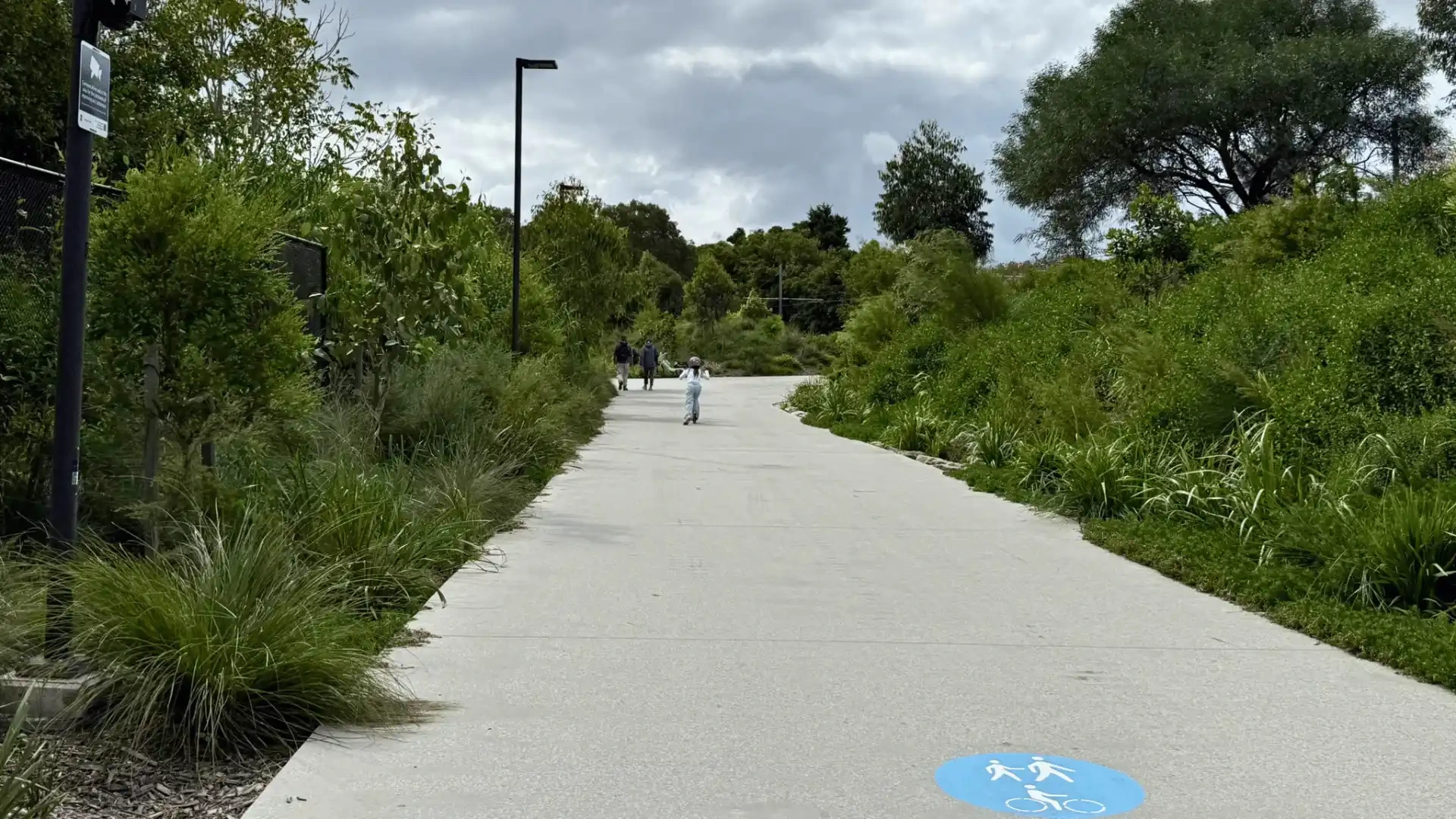
The sealed path runs almost entirely off-road
Following Hawthorne Canal through the northern section
Current status
Is the Inner West GreenWay open?
All high-priority construction works are now complete, including three new tunnels at Longport Street, Davis Street and Constitution Road, plus two new underpasses beneath Parramatta Road and New Canterbury Road. The opening drew thousands of people to Johnson Park in Dulwich Hill for the community celebration.
Navigation
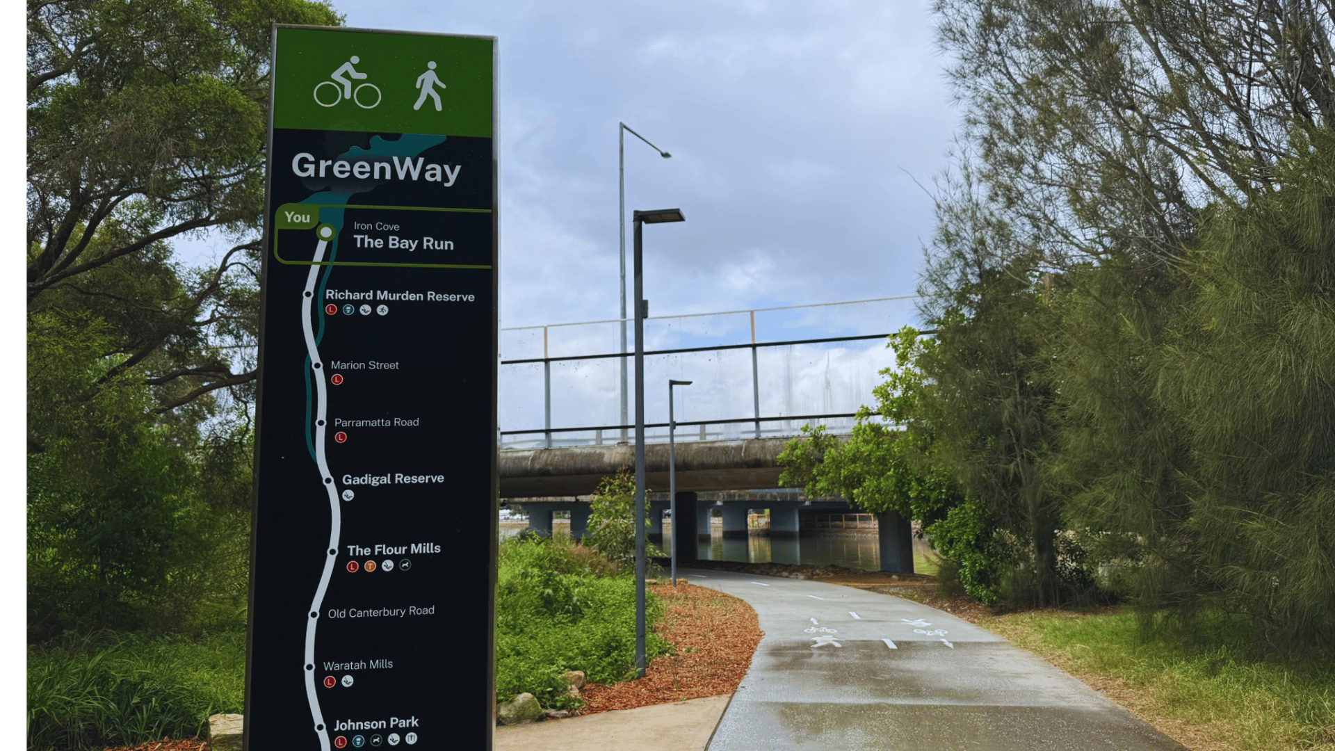
Inner West GreenWay map
The GreenWay runs from the Cooks River shared path at Earlwood, through Dulwich Hill, Lewisham and Summer Hill, before following Hawthorne Canal north to Iron Cove and the Bay Run.
Inner West Council publishes an official GreenWay map showing the full route, entrances, access points, public art locations and nearby light rail stops. It's worth downloading or saving before you go, especially if you plan to join or leave the path at different points along the way.

Access points
Where does the GreenWay start and end?
There are multiple entrances along the route, with the most popular at Johnson Park (Dulwich Hill), Lewisham West, Lilyfield and Earlwood.
Southern end: The path connects to the Cooks River shared path near Earlwood, providing links east toward the coast and west towards Sydney Olympic Park.
Northern end: It meets Iron Cove and the Bay Run near Lilyfield, making it easy to extend a walk or ride around the harbour.
Popular access points include Johnson Park in Dulwich Hill, Lewisham West near the light rail stop, the Lilyfield and Hawthorne Canal reserves, and Earlwood near the Cooks River path. Public transport runs alongside much of the corridor, so it's easy to start in one place and finish in another.
Lilyfield entrance near Iron Cove
Lewisham West, near light rail
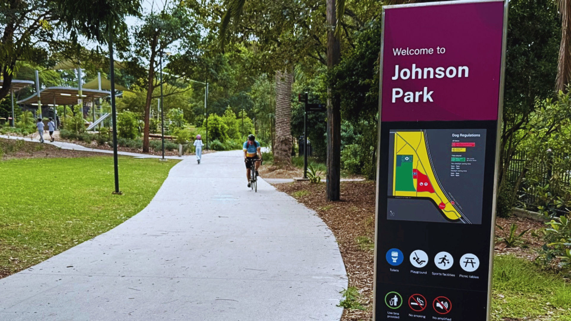
Johnson Park entrance, Dulwich Hill
The route
The six GreenWay precincts
The GreenWay is divided into six distinct precincts, each with a different character. Listed north to south, which is the way most people walk the route starting from Iron Cove.
Iron Cove to Marion Street
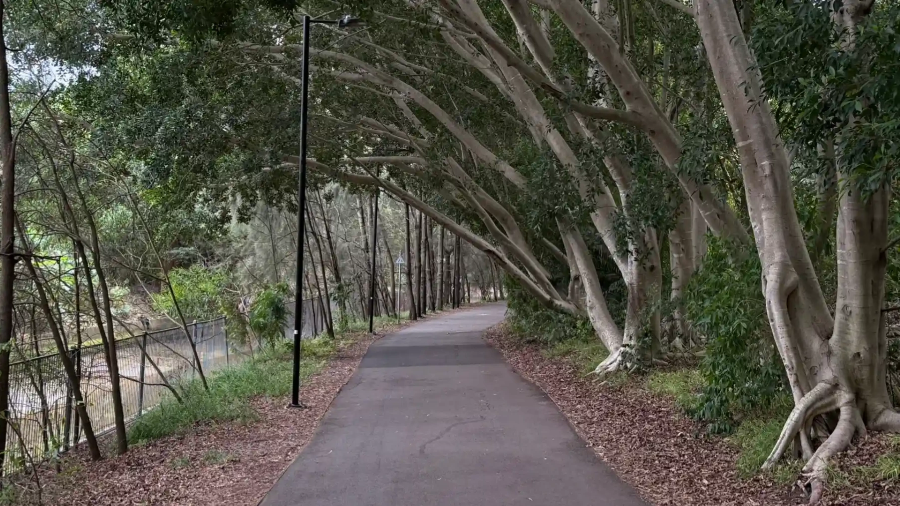
Hawthorne Canal precinct
This northern stretch follows Hawthorne Canal through Richard Murden Reserve and Hawthorne Reserve. It's open and park-like, with wide paths, ovals, playgrounds and water views. Particularly popular with families and anyone connecting to the Bay Run. A street library sits near the Hawthorne light rail stop at Café Bones reserve.
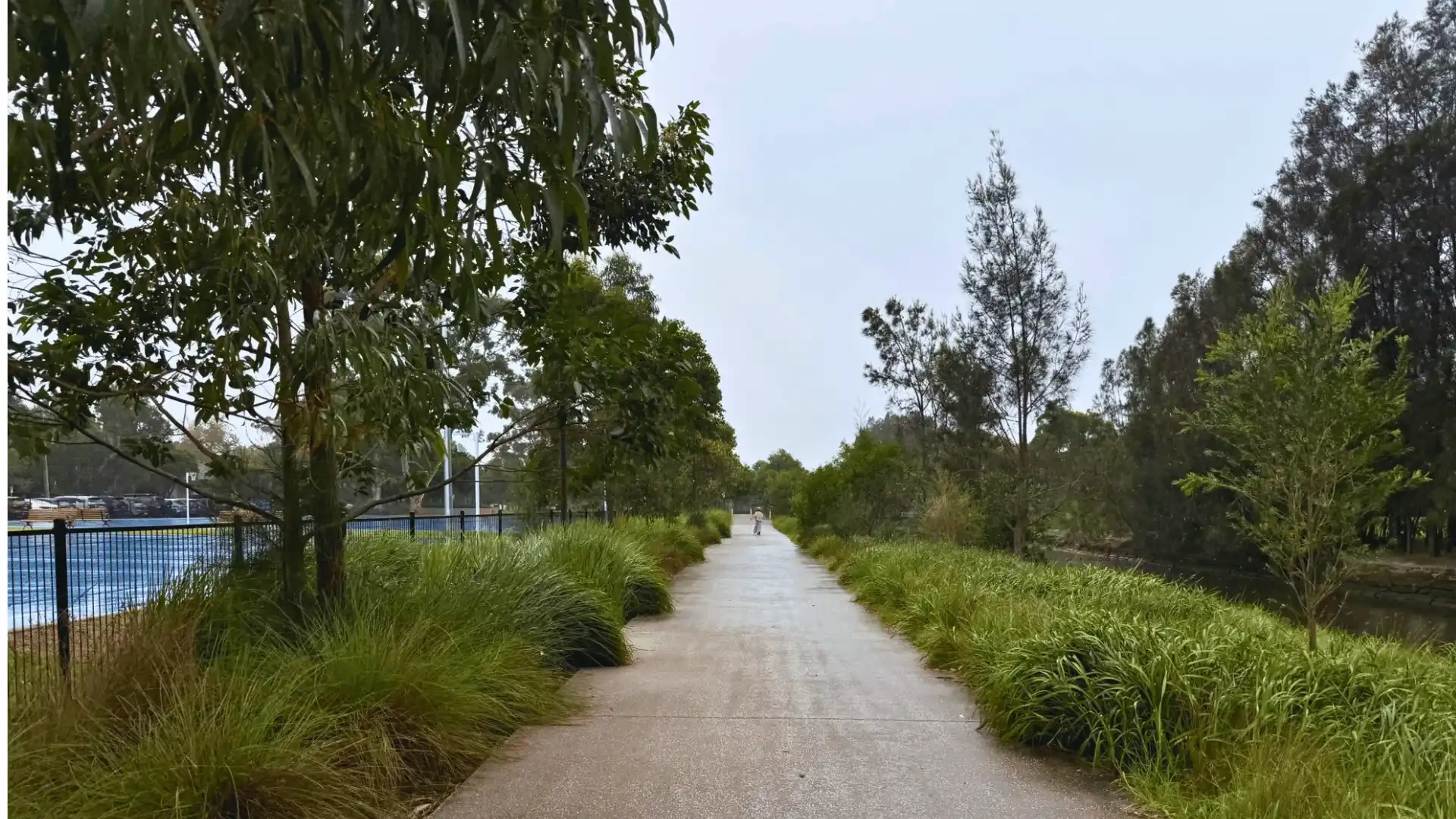
The Hawthorne Canal section offers water views and open parkland
Marion Street to Longport Street
Gadigal Reserve precinct
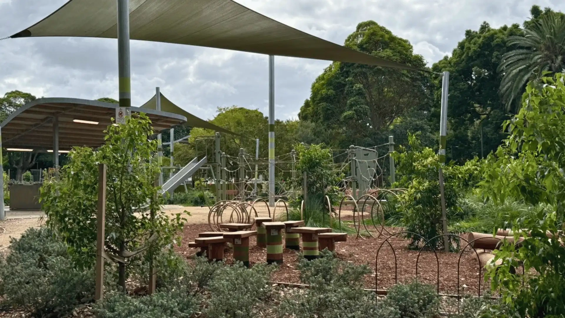
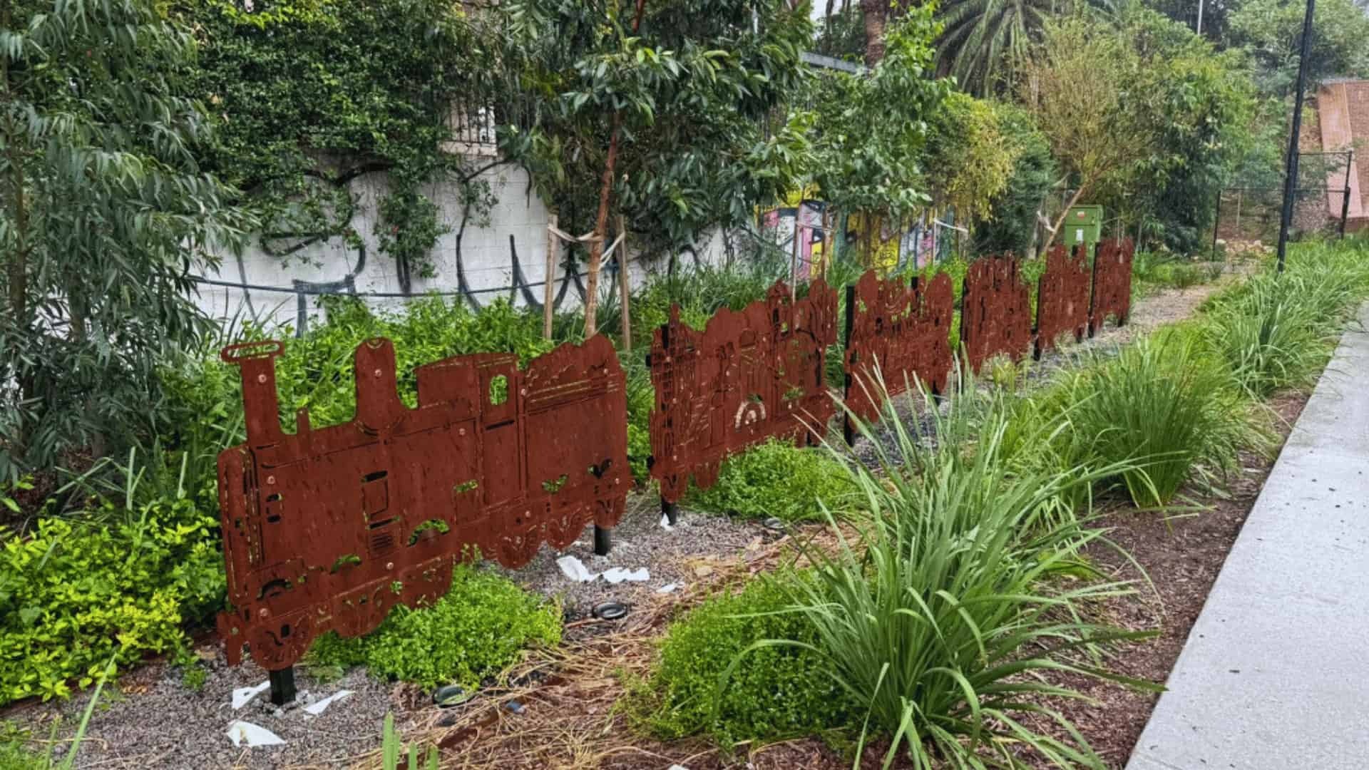
South of Marion Street, the path dips under Parramatta Road and enters Gadigal Reserve. This section feels bushier, with fig trees, new native plantings and active bushcare sites. It's also home to two of the corridor's standout public artworks: Benjamin Muir's Sedimentary Earth Core and Jasmine Sarin's nature-play sculpture Ngaraora (Glossy Black Cockatoo), which doubles as a kids' climbing space.
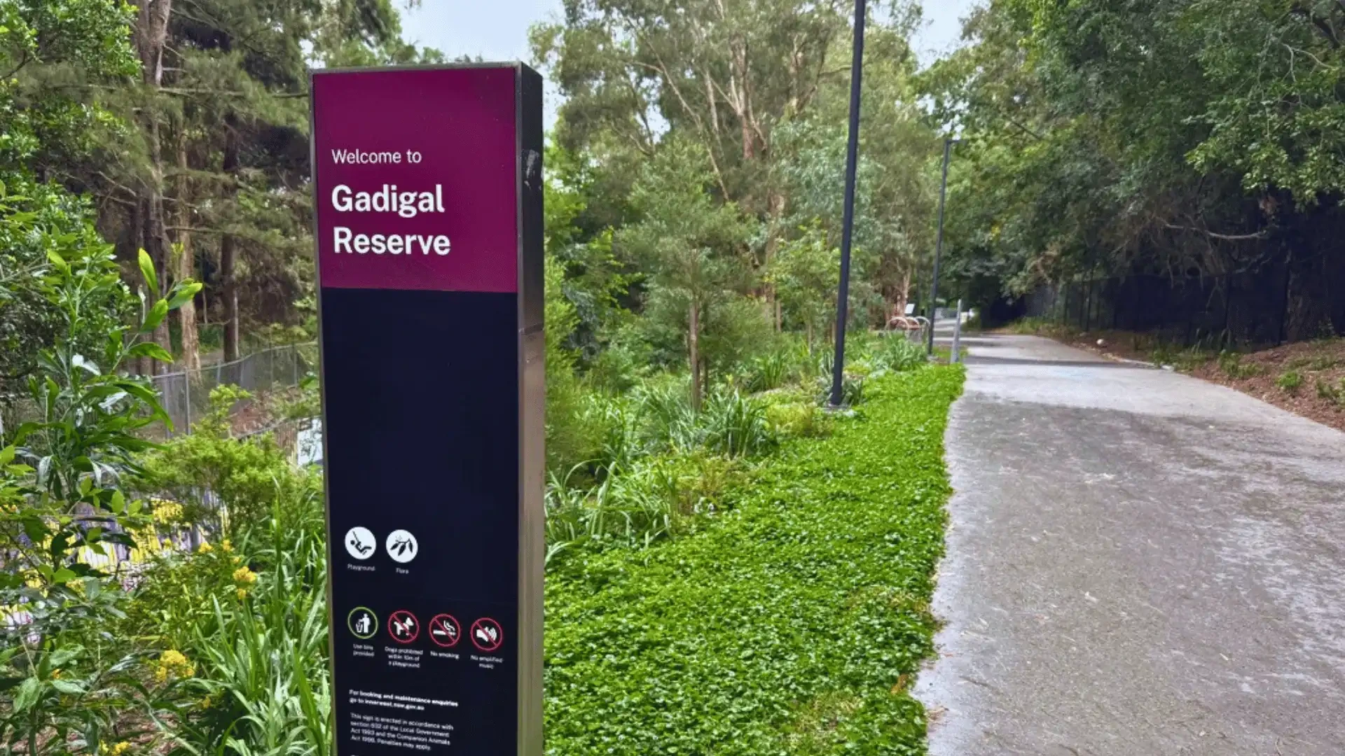
Gadigal Reserve: bushier feel with heritage figs and public art
Lewisham West
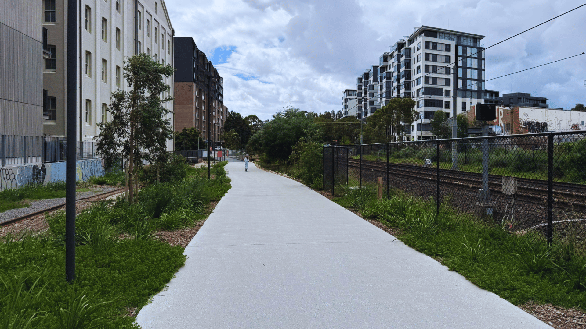
Mills precinct
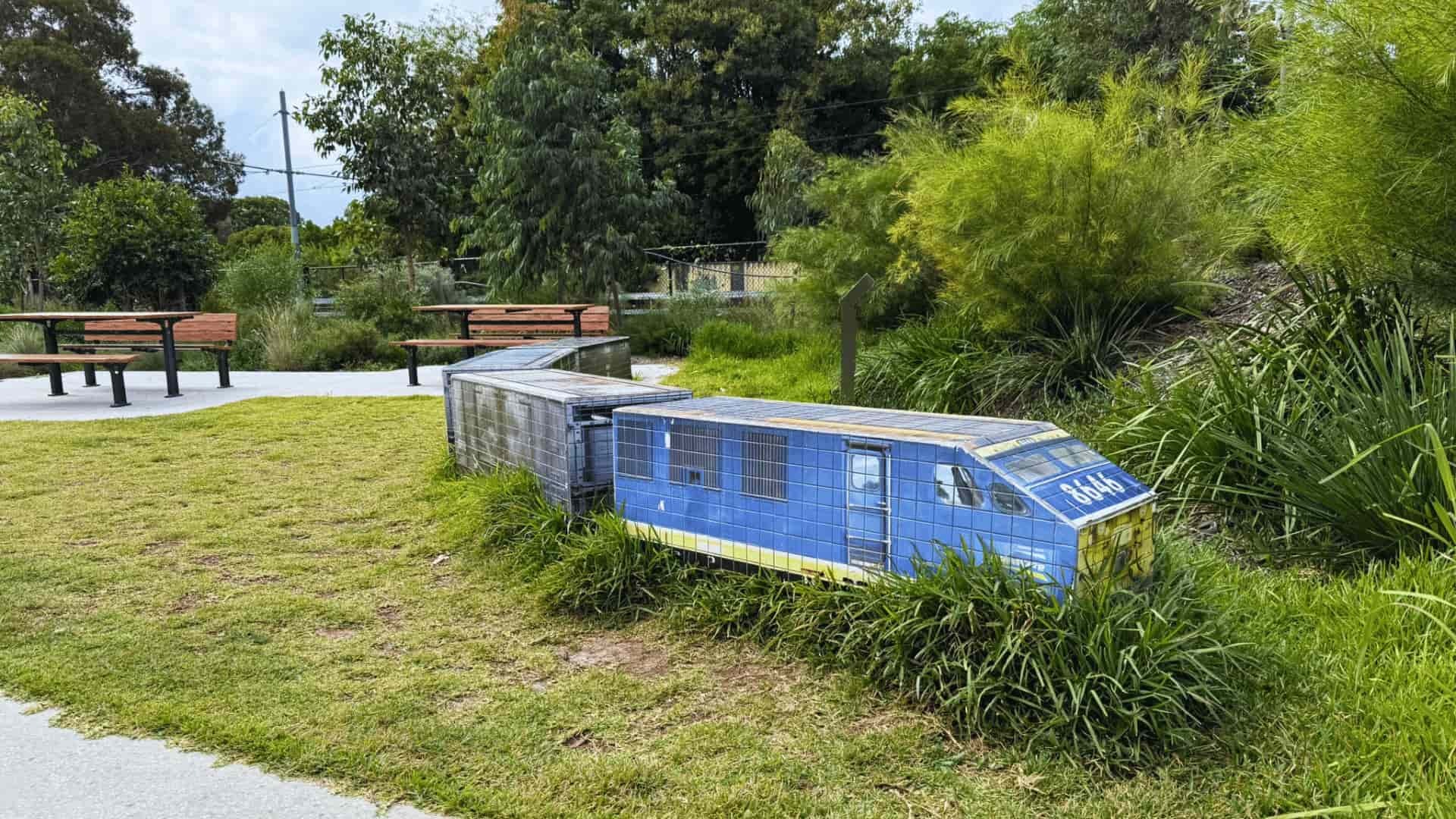
Around Lewisham West, the route passes the former Mungo Scott Flour Mills site, built in 1921 alongside what was then a goods line and operational until 2009. The site has since become a mixed-use commercial and residential precinct. You'll find remnants of rail infrastructure alongside new parkland, an off-leash dog area and James Gulliver Hancock's artwork Connected Histories. Headlands Coffee is nearby for a mid-route stop.
The Mills precinct shows industrial heritage at Lewisham West
Weston Street to New Canterbury Road
Dulwich Hill parks precinct
This is the most park-dense and busiest part of the route. Johnson Park, Hoskins Park, Arlington Oval and Laxton Reserve sit back to back, creating a long stretch of open space. Johnson Park has public toilets, picnic areas, a recently upgraded playground, the heritage play rocket and Carla Gottgens' artwork Birds of a Feather. There's also a street library here. Note there's a short on-street section along Weston Street to reconnect with the shared path near Waratah Mills light rail stop.
Johnson Park is newly upgraded
New Canterbury Road to Ewart Street
Dulwich Grove precinct
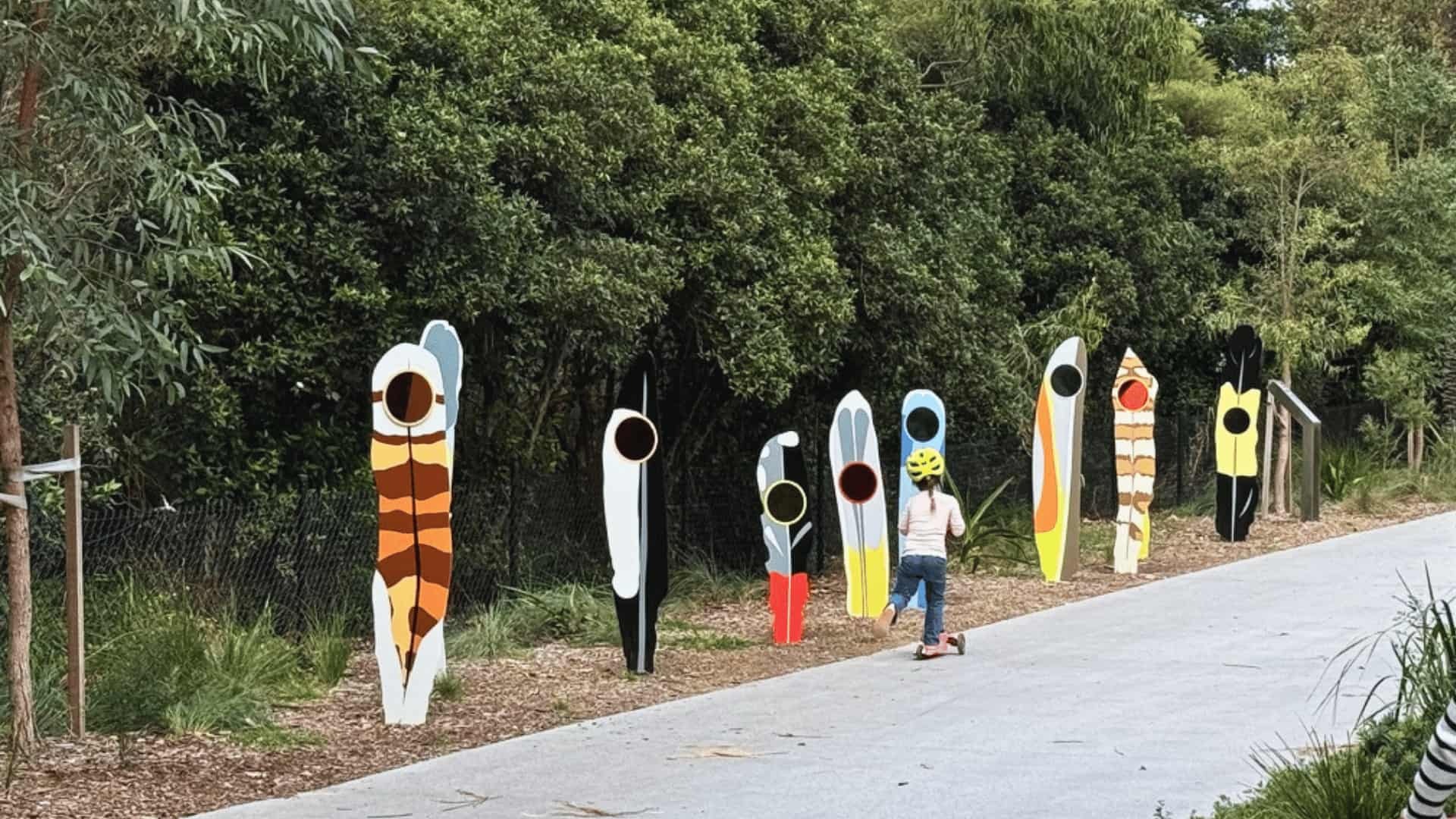
Further south, the route moves through newer parkland near Hercules Street and Jack Shanahan Reserve. Tree plantings here are younger but already creating shade and habitat. Two public artworks sit in the Hercules Street parklands: Hourglass Tree by Mark O'Ryan and Goods Stuff by James Voller, alongside picnic tables, a water fountain and a bike repair station. Jack Shanahan Reserve also has a skate park.
The Dulwich Grove section features newer plantings and two artworks
Earlwood
Cooks River precinct
The southernmost section uses quiet signposted streets near the golf course before meeting the Cooks River shared path at Ewen Park. It's an important connection into a larger regional walking and cycling network. Ewen Park has both a playground and a skate park right at the Cooks River end of the GreenWay.
How to use it
Easy routes to start with
Different people use the route in different ways. These are starting points rather than rules.
Dulwich Hill sampler
Iron Cove to Summer Hill
End to end (6km)
Outdoor gallery
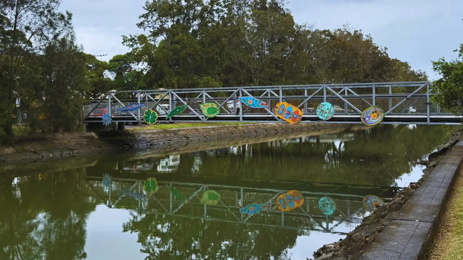
Public art along the GreenWay
The route functions as a linear outdoor gallery, with eight site-specific artworks distributed along the corridor. Council maps show artwork locations if you want to plan a dedicated art walk, but most people encounter them naturally as they go.
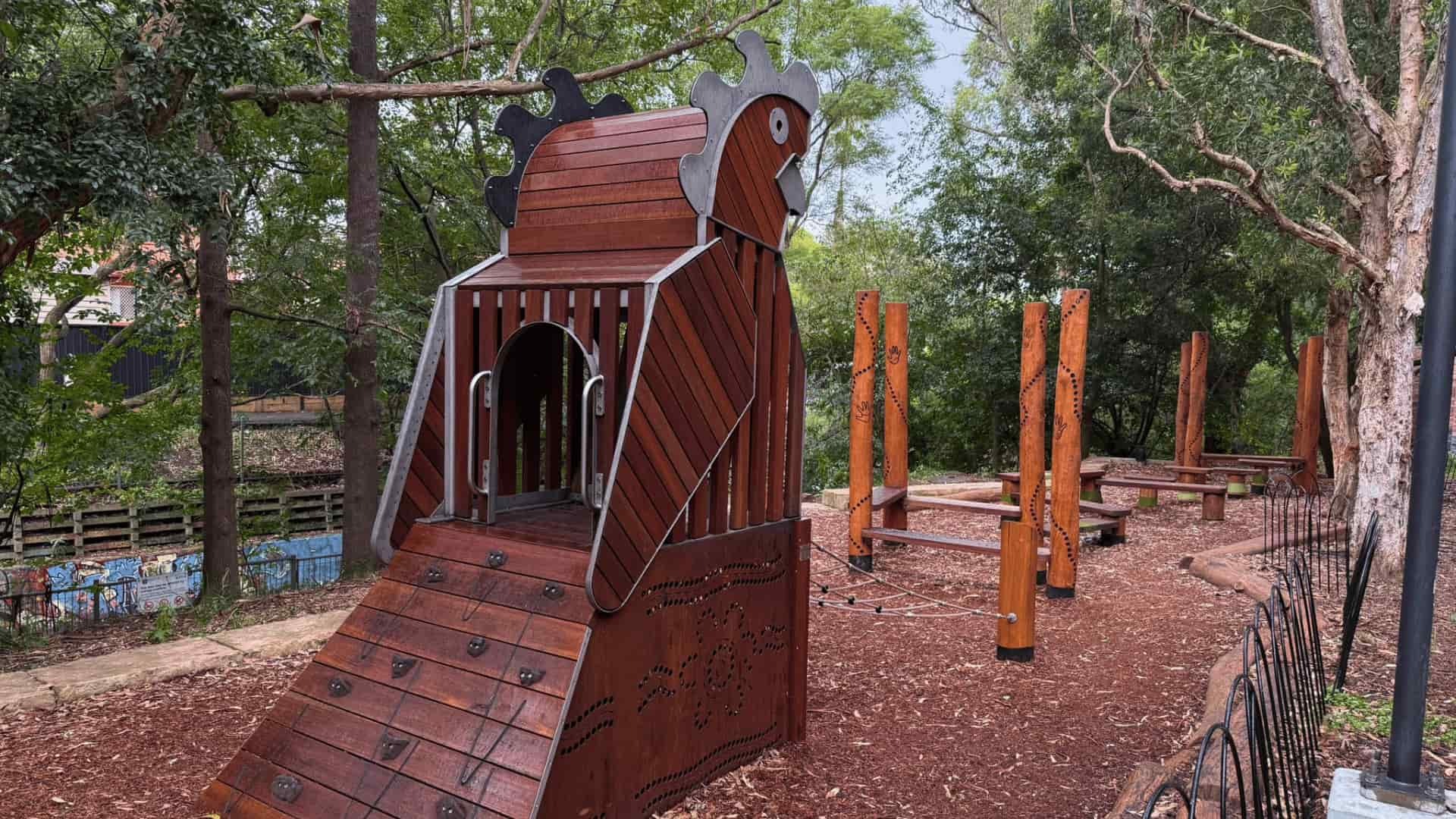
Ngaraora (Glossy Black Cockatoo)
Jasmine Sarin
Gadigal Reserve, Summer Hill
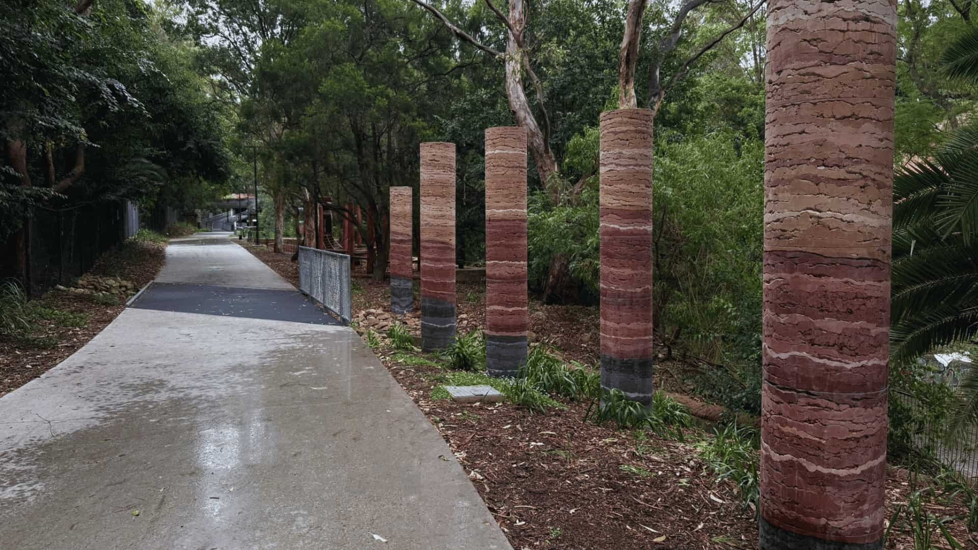
Sedimentary Earth Core
Benjamin Muir
Gadigal Reserve, Summer Hill
Connected Histories
James Gulliver Hancock
Lewisham West
Birds of a Feather
Carla Gottgens
Johnson Park, Dulwich Hill
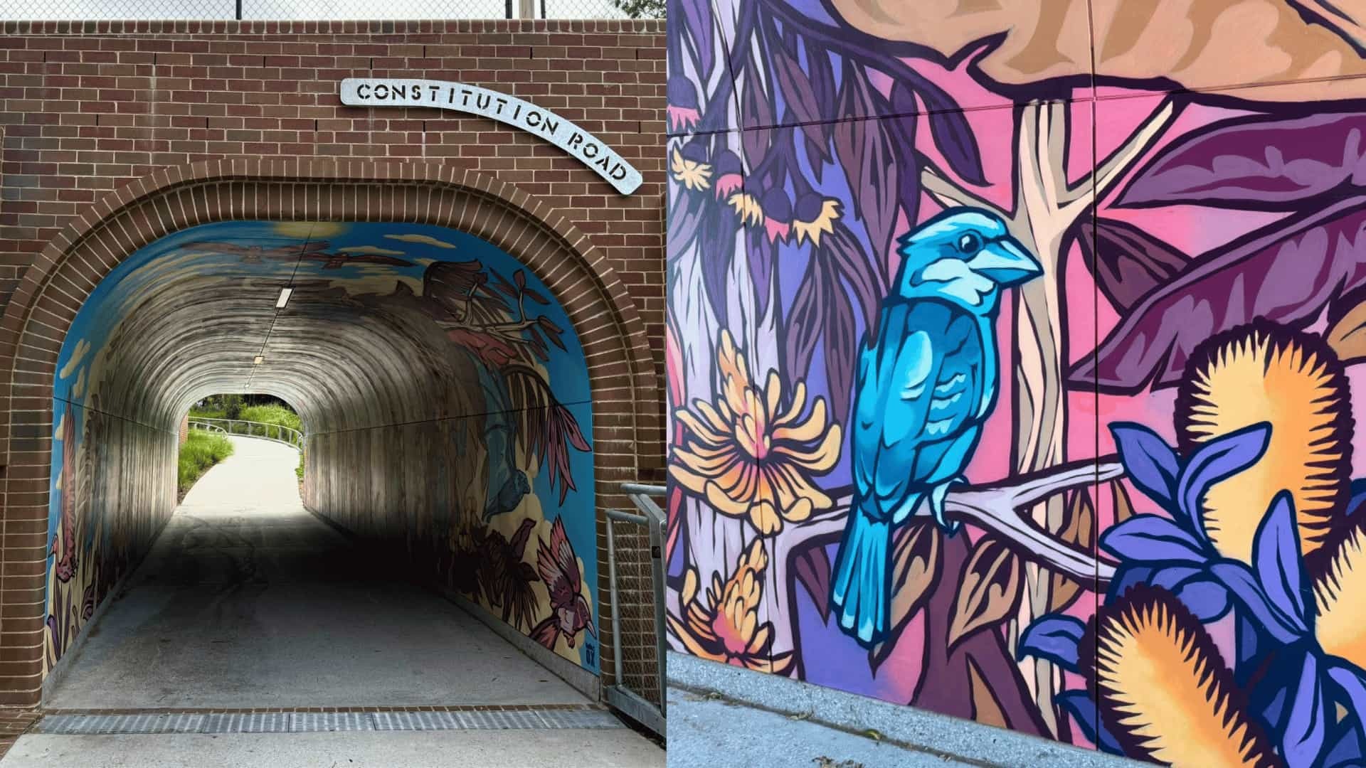
A Wild Life
OxKing
Constitution Road tunnel
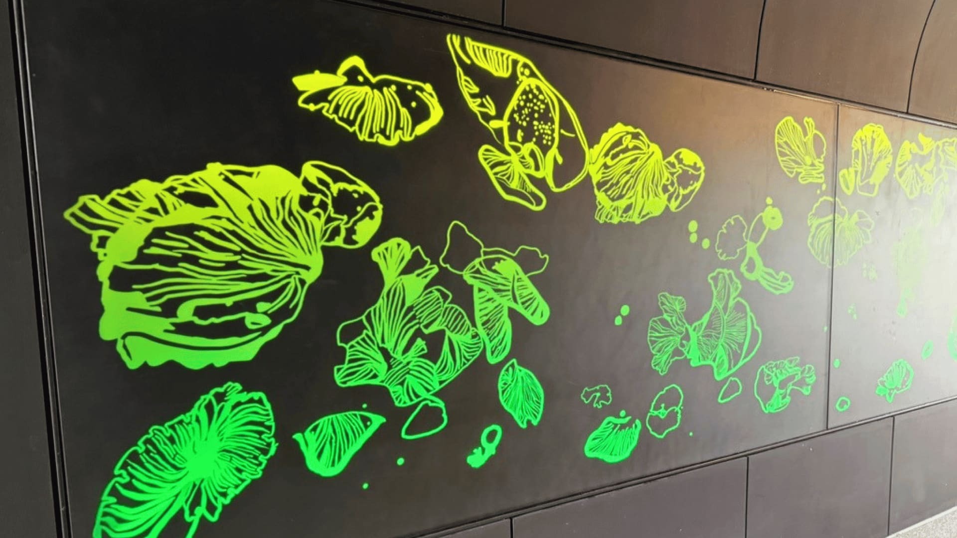
Dance of the Ghost Fungus
Dr Floria Tosca
Davis Street tunnel
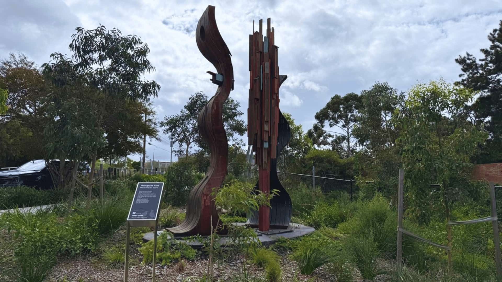
Hourglass Tree
Mark O'Ryan
Hercules Street Parklands
Goods Stuff
James Voller
Hercules Street Parklands
Family friendly
Using the GreenWay with kids
The path is sealed, mostly flat and suitable for prams, scooters and bikes. The whole route passes through or next to parks with playgrounds, so it's easy to break into smaller sections based on how far your kids will go before demanding a snack.
Toilet stops along the route (north to south):
Playgrounds and skate parks along the route:
Richard Murden Reserve
Playground at the northern end, near the Iron Cove start.
UpgradedGadigal Reserve
Jasmine Sarin's Ngaraora sculpture doubles as an interactive nature-play climbing space.
Nature playJohnson Park
The big one. Recently upgraded playground plus the iconic heritage rocket. Toilets, picnic areas and shade.
UpgradedHarvest Park
Playground on the southern stretch between Dulwich Hill and Jack Shanahan Reserve.
Jack Shanahan Reserve
Skate park in the Dulwich Grove precinct, alongside the Hercules Street artworks.
Skate parkEwen Park
Playground and skate park right at the Cooks River end. Good finish-line reward.
Skate parkThere are no kiosks directly on the path, so bring water and snacks. Drinking water fountains are dotted along the route, including within most of the parks. Bike repair stations are also available at several points if you're riding.
More to know
Nature, wildlife and history
Beyond recreation, the corridor acts as a biodiversity link through a densely built part of Sydney. Bushcare volunteers are restoring patches of Sydney Turpentine–Ironbark Forest and wetland plantings along Hawthorne Canal.
The route also layers multiple histories. It crosses Gadigal and Wangal Country, with sections historically known as Djarrawunang (Magpie). Long Cove Creek (now Hawthorne Canal) marked a boundary between clan areas and provided food and fresh water for tens of thousands of years.
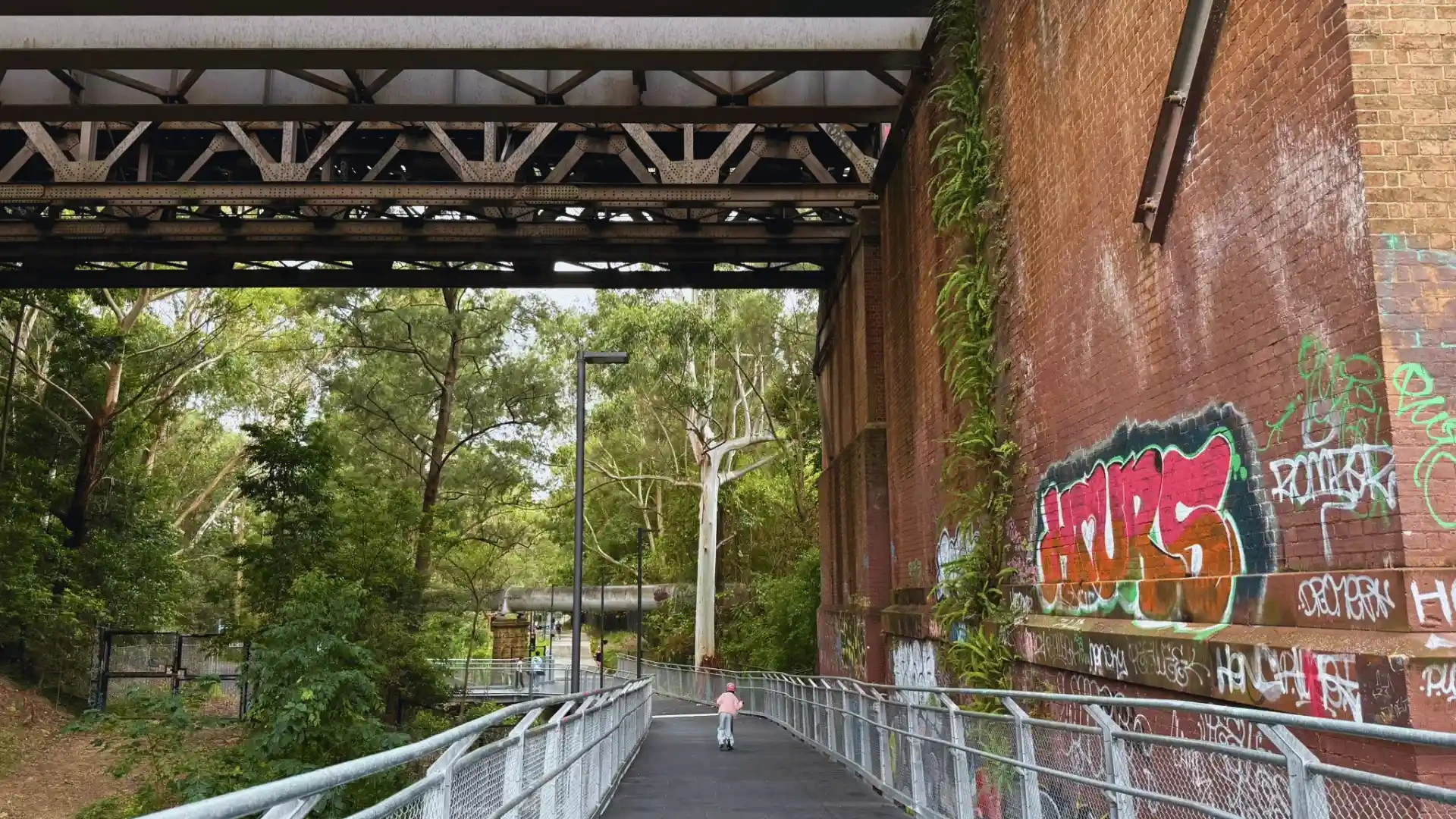
Later infrastructure includes 19th-century sewer and water works, early road links between Sydney Cove and Parramatta, the Rozelle goods line opened in 1914, and mills, tanneries and brickworks that shaped the Inner West. The original Long Cove Creek railway viaduct dates to 1855. Much of that history is visible along the walk if you know where to look.
Coming up
What's next for the corridor
The MetroWay is coming
A 13.8km walking and cycling path running alongside the Southwest Metro will connect Bankstown to the GreenWay at Dulwich Hill. The MetroWay contract went to tender in February 2026, with completion expected by end of 2028. When finished, it will be possible to ride continuously from Bankstown through Marrickville and Campsie, connect to the GreenWay at Dulwich Hill, and carry on all the way to the Bay Run at Iron Cove.
The new Dulwich Hill station plaza also opened in February 2026 as part of the Southwest Metro project. The 1,200 square metre public space connects bus services, the light rail stop and the new metro station and is already a useful starting point for GreenWay users coming by train or bus.
At a glance
Quick reference
| Length | ~6km one way |
| Time | ~25 mins cycling / ~75 mins walking without stops |
| Best for | Walking, cycling, scootering, prams, dog walking (off-leash area at Lewisham West) |
| Accessibility | Sealed path, gentle gradients, mobility friendly; service animals welcome |
| Public transport | L1 light rail runs alongside most of the route; Dulwich Hill station (T3 and Southwest Metro) |
| Cost | Free |
| Good starting points | Iron Cove / Lilyfield, Johnson Park (Dulwich Hill), Earlwood / Cooks River |
| Parking | Limited street parking at James St Lilyfield, around Marion St Leichhardt, near Johnson Park, Keith St Dulwich Hill |
| Toilets | Richard Murden Reserve, Hudson Street Park, Johnson Park, Jack Shanahan Reserve, Ewen Park |
| Last updated | April 2026 |
Common questions